Pakistan’s north holds some of the most dramatic mountain scenery on Earth, three of the world’s great ranges, the Himalaya, Karakoram and Hindu Kush, meet here, around valleys, alpine lakes and one of the highest plateaus on the planet. This guide picks the 11 most beautiful places in the country and gives each one the same honest treatment, what it actually is, how to reach it from Islamabad, the best months to go, and the practical catch that brochures skip.
A note on prices: Entry, jeep and chairlift charges in the north vary by season and nationality, and published figures often disagree, so rather than print a number that may be wrong by the time you travel, this guide tells you where a fee exists and to confirm it at the gate.
The 11 places at a glance
| No. | Place | Region | From Islamabad | Best months |
|---|---|---|---|---|
| 1 | Hunza Valley | Gilgit-Baltistan | ~1 hr flight to Gilgit + 2–3 hrs by road, or 14–20 hrs by road | Apr–Oct |
| 2 | Skardu | Gilgit-Baltistan | ~1 hr flight, or 14–21 hrs by road | Apr–Oct |
| 3 | Deosai National Park | Gilgit-Baltistan | Day trip from Skardu (2.5–3 hrs each way to Sheosar Lake) | Mid-Jun–late Sep |
| 4 | Fairy Meadows | Gilgit-Baltistan | KKH to Raikot Bridge, jeep + 3–4 hr trek | May–Sep |
| 5 | Lake Saif ul Muluk | Kaghan Valley, KP | ~6–7 hrs to Naran + 30–45 min jeep | Jun–Sep |
| 6 | Lulusar Lake | Kaghan Valley, KP | ~6–7 hrs to Naran + 1.5–2 hrs by road | Jun–Sep |
| 7 | Swat Valley | Khyber Pakhtunkhwa | ~4–5 hrs by expressway | Apr–Oct (skiing Dec–Feb) |
| 8 | Neelum Valley & Arang Kel | Azad Kashmir | ~3–4 hrs to Muzaffarabad + 5–6 hrs to Kel | May–Oct |
| 9 | Chitral & the Kalash Valleys | Khyber Pakhtunkhwa | ~1 hr flight, or 10–12 hrs by road | May–Oct (festivals May, Aug, Dec) |
| 10 | Shogran & Siri Paye | Kaghan Valley, KP | ~5–6 hrs to Shogran incl. jeep from Kiwai | May–Oct (Shogran stays open in winter) |
| 11 | Jahaz Banda & Katora Lake | Upper Dir / Kumrat, KP | ~8–10 hrs to Thal + jeep & 3–4 hr trek | Jun–Sep |
1. Hunza Valley, the valley beneath Rakaposhi
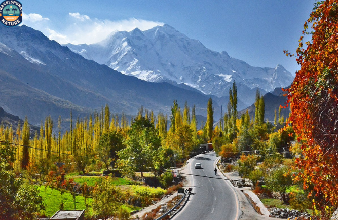
Hunza is the place most travellers name first, and it earns it, a high valley on the Karakoram Highway where the town of Karimabad sits beneath the sheer wall of Rakaposhi (7,788 m), one of the most beautiful mountains in the world. Two historic forts anchor the visit, Baltit Fort, the ~700-year-old seat of the Mirs of Hunza until 1945, beautifully restored and now a museum, and older Altit Fort, whose tower is about 1,100 years old, the oldest surviving monument in Gilgit-Baltistan. The same trip continues up the highway to Attabad Lake, the turquoise lake formed by a 2010 landslide, and on to the cathedral-like Passu Cones and the swaying Hussaini suspension bridge in Upper Hunza.
How to reach it: Fly Islamabad to Gilgit (about an hour, PIA’s ATR) then 2–3 hours up the Karakoram Highway, or drive the whole way from Islamabad in 14–20 hours, usually split over two days.
Best months: April to October, apricot and cherry blossom runs late March to mid-April, and the autumn colour peaks mid-October to early November.
The honest catch: The Gilgit flight is visual-weather only and cancels often, hold a spare day before anything fixed in your plan.
For the full breakdown, see our guide to the things to do in Hunza Valley.
2. Skardu, gateway to the Karakoram

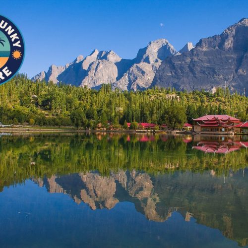
Skardu, at about 2,230 m where the Indus meets the Shigar River, is the base town of Baltistan, the launch point for K2 expeditions, and a destination in its own right. Its signature sights sit within an hour, Shangrila (Lower Kachura) Lake, with the famous resort founded in 1983 and its aircraft-fuselage restaurant, the quieter Upper Kachura Lake just beyond, better for boating and trout, and the Katpana Cold Desert, white dunes at 2,226 m, among the highest deserts in the world, just 20 minutes from town.
How to reach it: Flights from Islamabad take about an hour (PIA, Airblue and AirSial serve the route) but are weather-dependent, by road it’s 14–16 hours via Naran and the Babusar Pass in summer, or 18–21 hours on the Karakoram Highway, and most people split it over two days.
Best months: April to October.
The honest catch: Never book a same-day international connection out of Skardu, weather delays are normal, keep a buffer day. Skardu is also the base for Deosai (next) and for the Karakoram treks, K2, the world’s second-highest mountain at 8,611 m (28,251 ft), stands in this region, visible only to trekkers, but the reason this town exists on the map.
We have written a full guide to the best places to visit in Skardu, covering the Kachura lakes, Shigar and Khaplu, the two cold deserts and Deosai place by place.
3. Deosai National Park, the land of the giant

Deosai is the second-highest plateau in the world, some 3,000 km² of treeless alpine plains averaging 4,114 m (about 13,500 ft), between Skardu and Astore. Its name comes from the Shina words deo (giant) and sai (shadow), the shadow of the giant. The park was created in 1993 to protect the Himalayan brown bear, and the protection worked, the bears have recovered from just 19 in 1993 to roughly 70 today. Most visits drive across the plains to Sheosar Lake (4,142 m), a deep-blue lake at the plateau’s western end.
How to reach it: A full day trip by 4×4 from Skardu, about 1.5–2 hours to the park entrance past Sadpara Lake, and 2.5–3 hours each way to Sheosar Lake. An entry fee is collected in cash at the checkpost and varies by nationality, confirm it at the gate.
Best months: Mid-June to late September (sometimes into October in a good year), the plains are snowbound for roughly seven months.
The honest catch: Overnight camping inside the park has been banned since September 2025, after a brown bear attacked a camper, and seasonal hotels inside the park were banned that December. Plan Deosai as a long day trip from Skardu, whatever older guides say about camping at Bara Pani. There is no fuel, food, shop or mobile signal on the plateau, and you should spend at least a day in Skardu first to acclimatise.
4. Fairy Meadows, the meadow facing Nanga Parbat

Fairy Meadows is a grassland at about 3,300 m staring straight at the north face of Nanga Parbat (8,126 m), the world’s ninth-highest mountain. German climbers gave it its fairy-tale name (its local name is Joot), and the view across the meadow to the “Killer Mountain” is one of the great mountain panoramas in Asia. Wooden cottages and campsites dot the meadow, and the further viewpoint at Beyal Camp is a few kilometres on.
How to reach it: From Raikot Bridge on the Karakoram Highway, a ~15 km jeep track (1.5–2 hours) climbs to the village of Tato, a narrow, unpaved cliff-side track with no guardrails, driven only by experienced local union drivers (private vehicles aren’t allowed), and often described in travel writing as one of the world’s most dangerous roads. From Tato it’s a 3–4 hour uphill trek of about 5 km to the meadow, horses can be hired. Jeep fares are charged per vehicle (split between 5–6 passengers), confirm the current rate at Raikot.
Best months: May to September.
The honest catch: The jeep ride is genuinely nerve-testing if you dislike heights and drops, the trekking, however, is the reward, and accidents are rare precisely because only local drivers are permitted.
5. Lake Saif ul Muluk, the fairy-tale lake of Kaghan

Saif ul Muluk is a glacial lake at 3,224 m (10,578 ft) at the head of the Kaghan Valley, inside its own national park, with the valley’s highest peak, Malika Parbat (5,290 m), reflected in its water on calm mornings. The lake carries one of Pakistan’s best-loved stories, it is named for Prince Saif-ul-Muluk, the Egyptian prince of the classic tale versified by the Sufi poet Mian Muhammad Bakhsh, who is said to have fallen in love with the fairy princess Badi-ul-Jamal at this lake.
How to reach it: From the town of Naran (about 6–7 hours from Islamabad via Balakot), a jeep-only track climbs to the lake in 30–45 minutes, the walking trail takes 4–5 hours. Jeep rates vary by season, confirm in Naran.
Best months: June to September, the road opens around late May once the snow clears and the lake is frozen for much of the year.
The honest catch: Go before 9 a.m. In season the jeep queues and crowds build fast, and the famous Malika Parbat reflection is a morning phenomenon.
6. Lulusar Lake, the largest lake in the Kaghan Valley
Lulusar is the largest natural lake in the Kaghan Valley, a long sheet of blue-green water at 3,410 m (11,190 ft) that winds for about 3 km beside the road to Babusar Top. It is also where the Kunhar River begins, the river that runs the whole length of the valley past Naran and Balakot, so almost every Kaghan trip starts, in a sense, at this lake. The setting is open and bare compared with the pine forests lower down, high meadows and bare peaks reflected in the water on calm mornings.
The lake sits inside the Lulusar-Dudipatsar National Park, the protected area that also holds Dudipatsar Lake, reached on a trek from the village of Besal just below. Lulusar itself asks for no walking at all, it is a roadside stop with a viewing platform and a few tea stalls, and most visitors pair it with the drive on up to Babusar Top on the same road.
How to reach it: From Naran (about 6 to 7 hours from Islamabad via Balakot), the metalled N-15 road climbs about 48 km to the lake in roughly 1.5 to 2 hours, and ordinary cars can make the trip, there is no jeep track and no trek at the end. Jeeps hired in Naran run the same road as the standard Babusar day trip, with Lulusar as the main stop on the way up, confirm the fare in Naran.
Best months: June to September. The road beyond Naran only opens once the snow clears, usually around late May or June, and it closes again in autumn, and in winter the lake is frozen and snowbound.
The honest catch: There is almost nothing at the lake itself, a few tea stalls in season and no hotels, so it is a stop on the Babusar drive rather than a place to stay, and at 3,410 m the wind is cold even in July. Go early in the day for calm water and the reflections, by afternoon the wind usually roughens the surface.
7. Swat Valley, the easiest mountain escape
Swat is the mountain valley closest to the capital in spirit, a green river valley in Khyber Pakhtunkhwa reached by motorway and expressway, with the town of Mingora as its hub. Two different trips branch from it, north to Kalam (about 2–3 hours up the river road), a riverside base for the Ushu forest and jeep trips to Mahodand Lake, and up to Malam Jabba (about 1–1.5 hours), Pakistan’s best-known ski resort at ~2,800 m, with a chairlift and zipline, a green hill station in summer and the country’s one genuine ski destination from December to February.
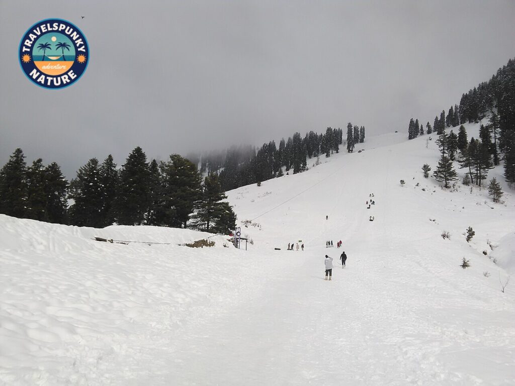
How to reach it: Islamabad to Mingora is about 247 km, roughly 4–5 hours via the Swat Expressway.
Best months: April to October for the valley and Kalam, January for the most reliable ski snow.
The honest catch: In the July–August monsoon the river road towards Kalam is the first thing to check after heavy rain, flash floods close it.
8. Neelum Valley and Arang Kel, Kashmir’s green corridor
The Neelum Valley runs for some 200 km north-east from Muzaffarabad along the Neelum River, through some of the greenest country in Pakistan, and its showpiece is Arang Kel, a meadow village on a shelf about 500 m above the river at Kel, with no road to it at all. You reach it by a chairlift (a doli) across the river from Kel, then a steep uphill walk of roughly 30–90 minutes depending on the path you take and your fitness, and arrive in a village of wooden houses and grazing horses above a sea of green ridges.
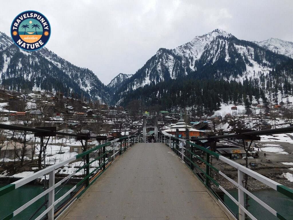
How to reach it: Islamabad to Muzaffarabad is about 3–4 hours, Muzaffarabad to Kel is a further 155–175 km, about 5–6 hours (the road is good to Athmuqam and rougher beyond Keran). Chairlift fares are modest and change, confirm at Kel.
Best months: May to October, snow closes the upper valley in winter.
The honest catch: The valley runs alongside the Line of Control, and the rules for foreign visitors to Azad Kashmir have changed more than once, current sources conflict, so foreign visitors should confirm the present position with the AJK Tourism Department or their operator before travelling, carry their passport for checkpost registration, and note that areas close to the Line of Control remain restricted. Pakistani nationals need only their CNIC.
9. Chitral and the Kalash Valleys, festivals at the edge of the Hindu Kush
Chitral is the far north-west, a remote district under the Hindu Kush, reached over the Lowari Tunnel or by a short flight, and the gateway to the Kalash Valleys, Bumburet, Rumbur and Birir, home of the Kalash people, known for their pre-Islamic culture and festivals. The festivals are the reason most visitors time a trip, Chilam Joshi in mid-May (spring), Uchau in August (the harvest), and Choimus around the winter solstice in December, the most sacred of the three.
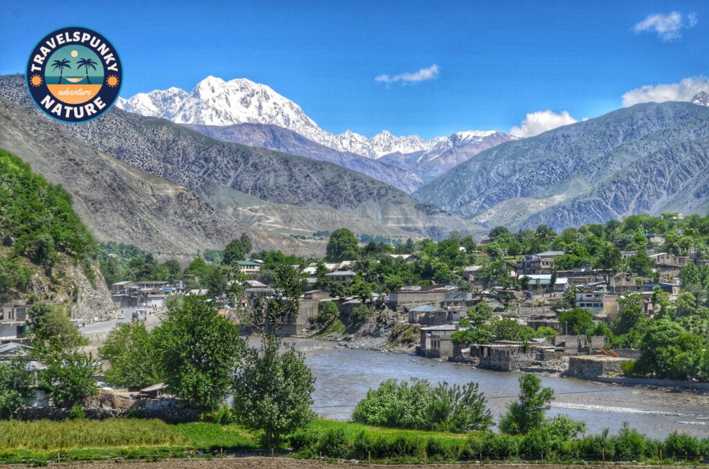
How to reach it: PIA flies Islamabad to Chitral in about an hour (weather-dependent and infrequent), by road it’s about 425 km and 10–12 hours via Dir and the Lowari Tunnel, which keeps Chitral connected year-round. The Kalash valleys are a further 2–2.5 hours by jeep from Chitral town via Ayun.
Best months: May to October, or festival dates.
The honest catch: Arrive a day early for festivals and behave as a guest, parts of Choimus are closed to outsiders. Pakistani nationals need no permit for the Kalash valleys, foreign visitors should carry their passport, expect checkpost registration and a small valley entry fee, and confirm any permit requirement in Chitral before travelling.
10. Shogran and Siri Paye, Kaghan’s family meadow
Shogran is a green plateau at 2,362 m in the Kaghan Valley, reached by a steep 7–8 km track (about 40 minutes) from Kiwai on the Balakot–Naran road. It is the family-friendly face of Kaghan, a strip of hotels across every budget, lawns, pine forest and horses for the children, no trek required. The famous view, though, is one more jeep ride up, Siri Paye, a broad meadow at about 3,000 m above Shogran, where the track passes little Siri Lake and ends at Paye Lake, in a panorama of Makra Peak (3,885 m, the “spider”), Malika Parbat and Musa ka Musalla. The Shogran-to-Siri Paye track (6–7 km, 30–45 minutes) is rougher than the Kiwai one and is jeep-only, walking up takes 2–3 hours.
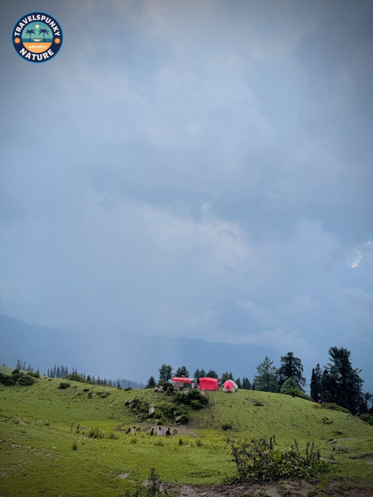
How to reach it: Islamabad to Kiwai is about 4–4.5 hours via the Hazara Motorway, Mansehra and Balakot, allow 5–6 hours door-to-door including the jeep up. Jeep fares are set at the Kiwai stand and rise in peak season, confirm before you set off. The Kiwai-to-Shogran track has been partly improved in recent years and some visitors now take cars up, but the standard advice is still to hire the jeep and park below.
Best months: May to October, peaking June–August.
The honest catch: Unlike Naran, Shogran does not fully close in winter, it draws snowfall visitors from December to February, but most hotels shut, the Kiwai track can block temporarily after snow, and Siri Paye jeeps may not run in deep snow. Book one of the few open hotels and check the track before you go.
11. Jahaz Banda, Kund Banda and Katora Lake, the Kumrat trek chain
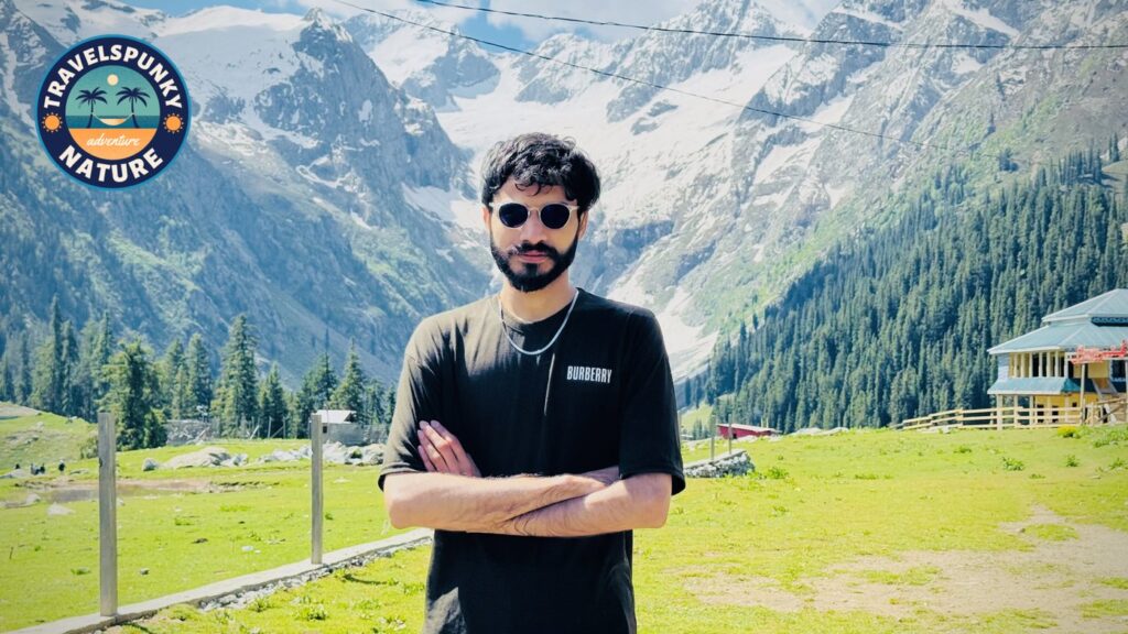
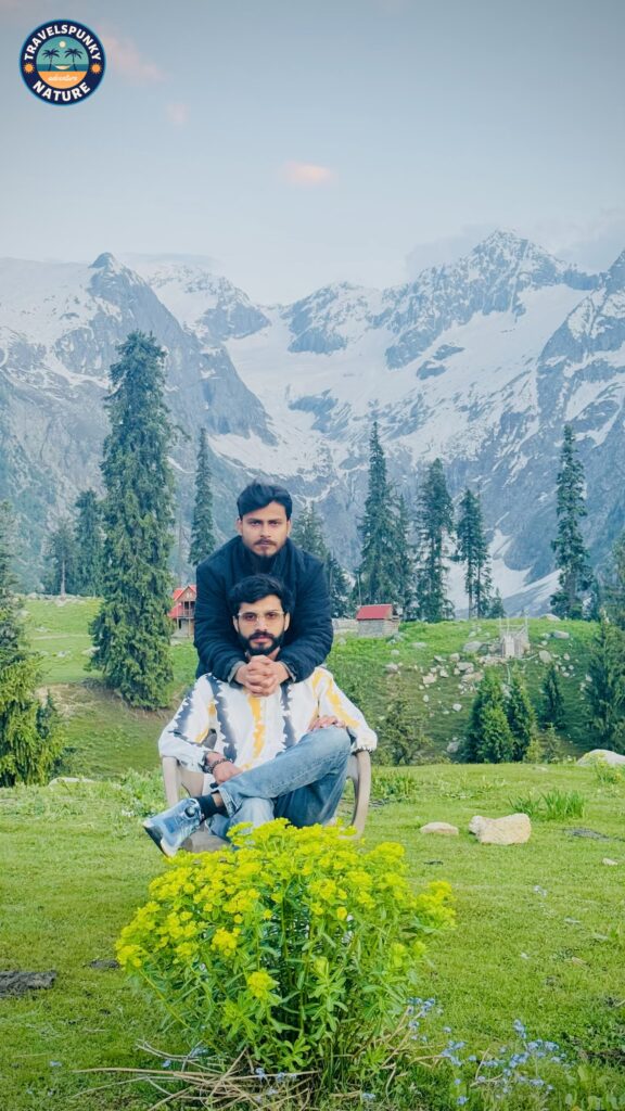
In the upper reaches of the Kumrat Valley in Upper Dir, one trek strings together three of the north’s quieter beauties. The base is Thal, the last town, where ordinary vehicles stop and jeeps take over for the rough 16 km track to Taki Banda. From there a 3–4 hour climb of about 6 km reaches Jahaz Banda (3,100 m), a wide, flat meadow with simple hotels, rentable camping gear and hotel kitchens, made for an overnight. A side walk of an hour or two leads to Kund Banda, a quieter meadow with a stream running through it and a waterfall nearby. And the next morning’s harder climb, about 4.5 km and 3–4 hours, the path fading in places and ending in a rock scramble, reaches Katora Lake (3,500 m), a deep lake in a natural bowl of rock (“katora” means bowl). There is no camping at the lake, you walk back down to Jahaz Banda the same day.
How to reach it: Islamabad to Thal is about 8–10 hours by road (M-1 and the Swat Motorway to Chakdara, then the N-45 through Timergara and Dir), jeep fares from Thal are negotiated on the spot and depend on whether the jeep waits, confirm before you commit.
Best months: June to September (Katora’s trail is best from late June, once the snow clears), the meadows are snow-covered and the jeep tracks closed for much of the rest of the year, and there is little to no mobile signal above Thal.
The honest catch: This is a two-trek trip, not a viewpoint, jeep day, climb, sleep, climb again. Trying to reach Katora Lake from the valley floor in a single day is a mistake. A note for foreign visitors, Upper Dir is one of the districts covered by Khyber Pakhtunkhwa’s online foreign-tourist registration system (introduced in July 2025), register in advance and expect checkpost questions about your destination and stay. Pakistani nationals need no such registration.